INDONESIA FROM ACROSS BORDERS (54)
A River as a Border Between Countries
My heart was beating really fast as the sun began to shine and the boat entered the Fly River, which divides the two countries. To the left of the river is Indonesia, and PNG to the right.

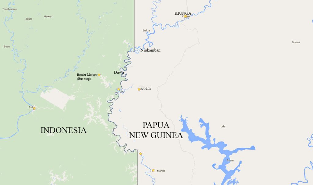
Map of the borders of Indonesia and Papua New Guinea. Location of international markets Indonesia-Papua New Guinea, as well as Kuem and Kiunga, Papua New Guinea
On the journey from Kuem to the town of Kiunga, I finally crossed the strangest area of the border between Indonesia and Papua New Guinea (PNG): the “swelling” of the Fly River.
I boarded the boat belonging to Raven, a middle-aged man from Kuem who was going to sell tilapia fish to Kiunga. We departed at 2 a.m.
Versi cetak artikel ini terbit di harian Kompas edisi di halaman 1 dengan judul "Sungai Pembatas Negeri".
Baca Epaper Kompas